Our Services
WaterWise provides a range of geospatial analytics services to support water rights, legal, and regulatory decision-making. Explore our example capabilities below.

Derive High Resolution Flowline Networks
Create detailed flowline networks in compliance with USGS EDH/3DHP specifications.
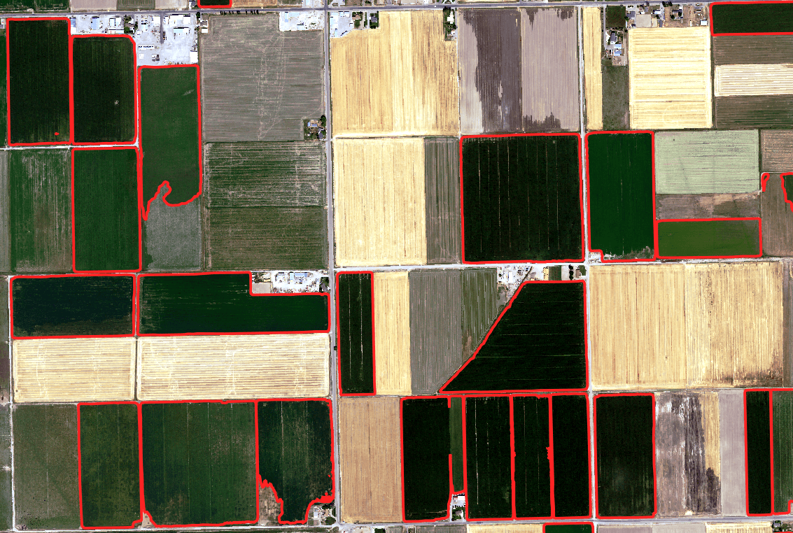
Delineating Irrigated Acreage
Precisely map irrigated boundaries and calculate total acreage using high-resolution remote sensing data.

Consumptive Use Analysis
Using satellite data to derive Evapo-Transpiration and determine how much water leaves a local watershed.

Evaluating Historical Beneficial Use
Analyze historical aerial and satellite imagery to map irrigated extents over time, creating a clear record to support beneficial use review.

Georeferencing Hydrographic Surveys
Georeference hydrographic surveys and reference high-resolution flow data on top of them for precise analysis.

Culvert and Drainage Inventory
Using proprietary machine learning models, WaterWise can identify and inventory culverts and drainage features.

Floodplain Risk Assessment
Assess accurate flood risk and dispute FEMA designations.